Emergency Weather Alert Radios: What They Are, How They Work, and Why You Need One
When a severe storm, wildfire, or other disaster strikes, cell towers go down, the internet cuts out, and television goes dark. An emergency weather alert radio is one of the few devices that keeps working — and keeps you informed — when everything else fails.
What is an emergency weather radio?
An emergency weather radio — often called a NOAA weather radio in the United States — is a dedicated receiver that picks up official emergency alerts broadcast by government agencies around the clock.
Unlike a regular AM/FM radio, it stays silent until a genuine alert is issued, then sounds an alarm and delivers the broadcast automatically.
In the US, alerts are broadcast by the National Oceanic and Atmospheric Administration (NOAA).
In Canada, a parallel network operates through Environment and Climate Change Canada.
Both systems use a network of high-frequency transmitters to blanket their respective countries with coverage.
NOAA Weather Radio All Hazards covers not just weather events, but also industrial accidents, public safety threats, terrorist alerts, and AMBER alerts — making it a true all-hazards system.
How does a weather alert radio work?
The network operates through hundreds of broadcast stations transmitting on dedicated VHF frequencies between 162.400 MHz and 162.550 MHz.
A government meteorologist or emergency manager issues an alert, which is encoded and broadcast from the nearest transmitter.
Your radio detects the signal and triggers an audible tone and voice message.
If your radio supports SAME technology, it only wakes for alerts in your specific county.
The result is a device that can sit silently on a shelf for months and still wake you at 3 a.m. if a tornado warning is issued for your area.

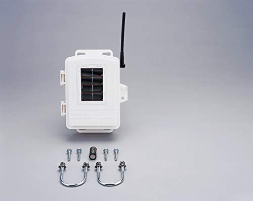
Sainlogic vs Acurite 5 in 1
Why you need one — even in 2026
Smartphones and smart speakers have made it easy to assume weather alerts are covered. They often are — until a disaster knocks out the infrastructure those devices depend on. Power outages, downed cell towers, and overwhelmed networks are common during the exact events when you need information most.
An emergency weather radio solves this because it receives a direct government broadcast with no internet required, runs on batteries or a hand crank if AC power is unavailable.
It also works automatically even while you are asleep, and covers hazards beyond weather including chemical spills and AMBER Alerts.
Types of weather radios
Desktop and tabletop radios are designed to sit in a bedroom, kitchen, or office.
These plug into an outlet but typically include a battery backup, making them the best choice for households that want reliable, always-on home coverage.
Portable and handheld radios are compact units powered by batteries or rechargeable cells.
They are ideal for camping, hiking, and travel — anywhere you might be away from home when conditions change.
Multi-purpose emergency radios combine a NOAA receiver with an AM/FM tuner, flashlight, USB charging port, solar panel, and hand-crank generator in a single device.
These are a popular choice for emergency preparedness kits.

AcuRite Iris 5-In-1
Key features to look for
SAME technology (Specific Area Message Encoding) lets you program the radio to only alert for your county, filtering out warnings from distant areas that don't affect you.
Alert and alarm mode keeps the radio silent during normal conditions and sounds a tone the moment an official alert is detected — even from standby.
Multiple power sources are essential. Look for AC power plus battery backup, a hand-crank generator, and ideally a solar panel so the radio works regardless of grid conditions.
Portability matters if you plan to use the radio outside the home.
A compact, durable build means you can take it camping, keep it in a car kit, or move quickly if you need to shelter elsewhere.
A built-in LED flashlight is a practical bonus when a storm knocks out power.
A USB charging port lets you keep a phone or other device alive when outlets are unavailable.
Frequently asked questions
Is a NOAA weather radio the same as an emergency alert radio? Essentially, yes. "NOAA Weather Radio" refers to the US government's broadcast network specifically.
The radios that receive it are sold under various names — emergency alert radio, weather alert radio, NOAA radio — but they all receive the same signal.
Do I still need one if I have a weather app on my phone?
Yes. Phone alerts depend on cellular service, which is often the first infrastructure to fail during a major storm or disaster.
A dedicated radio receives a direct government broadcast that does not rely on the internet or cell towers.
What does SAME mean on a weather radio? SAME stands for Specific Area Message Encoding.
It allows you to program your radio to only sound alerts for specific counties or regions, so you are not woken by warnings that don't apply to your area.
What is the best power source for an emergency weather radio? The safest choice is a radio with multiple power options:
AC outlet for everyday use, replaceable or rechargeable batteries as a backup, and a hand-crank or solar panel as a last resort.
This layered approach ensures the radio works no matter what happens to the power grid